Illustration: Political Map Of Middle East, Or Near East, In Grey. Simple Flat Vector Ilustration
ID 108272421 © Pytyczech | Megapixl.com
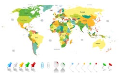
Political map of Middle East, or Near East, in grey. Simple flat vector ilustration.
CATEGORIES
Sharing is not just caring, it's also about giving credit - add this image to your page and give credit to the talented photographer who captured it.:
KEYWORDS
arab arabia arabian asia continent country east egypt emirates geography graphic gray grey gulf illustration iran iraq isil isis islamic israel jordan kuwait lebanon levante map mediterranean middle oman palestine persian qatar region saudi sea state syria turkey uae united vector war yemen
More images on Dreamstime


Similar Images


More images by the same author


1 week free trial. Any size, for free
Renews at $25/month, cancel or upgrade at any time
Click here for your free trial!240,995,880 images | 1,214,985 contributors | 53,326,610 total users