Search results
Illustration: Vector Maps Set. High Detailed 15 Maps Of Middle East Countries With Administrative Division And Cities. Political Map, Map Of
ID 143041948 © Molokowall | Megapixl.com
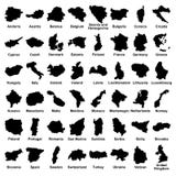
Vector maps set. High detailed 15 maps of Middle East countries with administrative division and cities. Political map, map of Middle East region, world map, globe, infographic elements
CATEGORIES
Your image is downloading.
Sharing is not just caring, it's also about giving credit - add this image to your page and give credit to the talented photographer who captured it.:
More images on Dreamstime


Similar Images


More images by the same author


Special Dreamstime offer
1 week free trial. Any size, for free
Renews at $25/month, cancel or upgrade at any time
Click here for your free trial!240,321,448 images | 1,213,169 contributors | 53,254,428 total users