Search results
Illustration: Vector Maps Set. High Detailed 45 Maps Of European Countries With Administrative Division And Cities. Political Map, Map Of
ID 142001699 © Molokowall | Megapixl.com
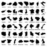
Vector maps set. High detailed 45 maps of European countries with administrative division and cities. Political map, map of Europe continent, world map, globe, infographic elements. Part 2
CATEGORIES
Your image is downloading.
Sharing is not just caring, it's also about giving credit - add this image to your page and give credit to the talented photographer who captured it.:
More images on Dreamstime


Similar Images


More images by the same author


Special Dreamstime offer
1 week free trial. Any size, for free
Renews at $25/month, cancel or upgrade at any time
Click here for your free trial!240,682,725 images | 1,214,081 contributors | 53,294,389 total users