Illustration: Southern Africa Political Map
ID 97898861 © Peterhermesfurian | Megapixl.com
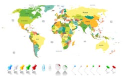
Southern Africa political map with borders of the countries and English labeling. The southernmost region of the African continent. Gray illustration on white background. Vector.
CATEGORIES
Sharing is not just caring, it's also about giving credit - add this image to your page and give credit to the talented photographer who captured it.:
KEYWORDS
africa angola atlas background border botswana boundary cabinda cartography central congo continent country destination english geography gray illustration labeling land lesotho malawi map mozambique namibia nation political region south southern state swaziland tanzania travel vector white zaire zambia zimbabwe
More images on Dreamstime


Similar Images


More images by the same author


1 week free trial. Any size, for free
Renews at $25/month, cancel or upgrade at any time
Click here for your free trial!242,354,834 images | 1,219,205 contributors | 53,462,141 total users