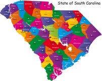
Illustration: South Carolina, Sc, Gray Political Map, The Palmetto State
ID 199571904 © Peterhermesfurian | Megapixl.com
South Carolina, SC, gray political map, with capital Columbia, largest cities and borders. State in the southeastern region of the United States of America. The Palmetto State. Illustration. Vector.
CATEGORIES
Sharing is not just caring, it's also about giving credit - add this image to your page and give credit to the talented photographer who captured it.:
KEYWORDS
america americas atlantic atlas beach border capital carolina cartography charleston columbia country creek deep florence geography georgia goose gray greenville hill illustration lake map mapping mount murray myrtle north palmetto pleasant political rock south southeast southeastern spartanburg state states summerville sumter travel united usa vector
More images on Dreamstime


Similar Images


More images by the same author


1 week free trial. Any size, for free
Renews at $25/month, cancel or upgrade at any time
Click here for your free trial!240,967,392 images | 1,214,837 contributors | 53,323,526 total users