Search results
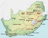
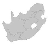
Illustration: South Africa Political Map
ID 82229359 © Peterhermesfurian | Megapixl.com
South Africa political map with the capitals Pretoria, Bloemfontein and Cape Town. With national borders and neighbor countries. Gray illustration with English labeling on white background. Vector.
CATEGORIES
Your image is downloading.
Sharing is not just caring, it's also about giving credit - add this image to your page and give credit to the talented photographer who captured it.:
More images on Dreamstime


Similar Images


More images by the same author


Special Dreamstime offer
1 week free trial. Any size, for free
Renews at $25/month, cancel or upgrade at any time
Click here for your free trial!240,602,919 images | 1,213,966 contributors | 53,284,938 total users