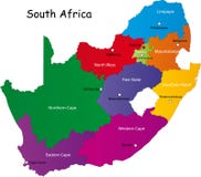
Illustration: South Africa - Map Of Provinces
ID 200640186 © Pytyczech | Megapixl.com
Blue political map of South Africe, RSA. Administrative divisions - provinces. Simple flat vector map with labels.
CATEGORIES
Sharing is not just caring, it's also about giving credit - add this image to your page and give credit to the talented photographer who captured it.:
KEYWORDS
administrative africa african areas blue border boundary business cape cartography colored colorful contour country county department design district division education geography graphic infographic infographics johannesburg label land limpopo map modern name nation outline politic political province region rsa shape silhouette south state template territory travel vector
More images on Dreamstime


Similar Images


More images by the same author


1 week free trial. Any size, for free
Renews at $25/month, cancel or upgrade at any time
Click here for your free trial!242,439,423 images | 1,219,548 contributors | 53,470,185 total users