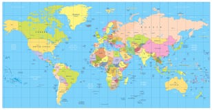
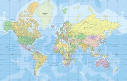
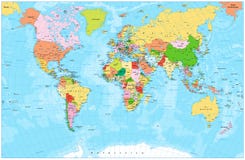
Colored political world map with black labels of sovereign countries and larger dependent territories. Simplified map. South Sudan included.
CATEGORIES
Sharing is not just caring, it's also about giving credit - add this image to your page and give credit to the talented photographer who captured it.:
KEYWORDS
africa america asia atlas australia black border business cartography color continent continents countries country design detail detailed earth europe geography geopolitical global globalization globe illustration label land map name national north ocean oceania political south state text the transportation travel white with world
More images on Dreamstime


Similar Images


More images by the same author


1 week free trial. Any size, for free
Renews at $25/month, cancel or upgrade at any time
Click here for your free trial!242,450,289 images | 1,219,556 contributors | 53,471,519 total users