Illustration: Map Of Central America, Satellite View. Mexico And United States, Physical Map. Reliefs And Mountains.
ID 205635253 © Vampy1 | Megapixl.com
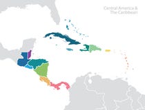
Map of Central America, satellite view. Mexico and United States, physical map. Reliefs and mountains. Elements of this image are furnished by Nasa. 3d render
CATEGORIES
Sharing is not just caring, it's also about giving credit - add this image to your page and give credit to the talented photographer who captured it.:
KEYWORDS
america arab are belize cartography central clouds continent earth east ecology elements emirates environment forecast furnished geography globe guatemala gulf heights honduras image landscape map mediterranean mexico mountains nasa nature nicaragua persian physical planet red relief reliefs render salvador satellite sea state states terrain this travel united view world
More images on Dreamstime


Similar Images


More images by the same author


1 week free trial. Any size, for free
Renews at $25/month, cancel or upgrade at any time
Click here for your free trial!242,803,751 images | 1,220,768 contributors | 53,501,599 total users