Illustration: Central America Countries, Subregion Of The Americas, Political Map
ID 279068167 © Peterhermesfurian | Megapixl.com
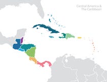
Central America countries,colored political map. Subregion of the Americas,between Mexico and Colombia,consisting of Belize,Guatemala,Honduras,El Salvador,Nicaragua,Costa Rica and Panama.
CATEGORIES
Sharing is not just caring, it's also about giving credit - add this image to your page and give credit to the talented photographer who captured it.:
KEYWORDS
central america central subregion americas countries country map caribbean mesoamerica panama costa rica nicaragua guatemala honduras salvador belize colombia state colored mexico caribbean sea north pacific pacific ocean isthmus geography darien gap south tehuantepec volcanic arc land mapping atlas overview cartography coast coastline border travel cruise sailing destination political infographic white background vector
More images on Dreamstime


Similar Images


More images by the same author


1 week free trial. Any size, for free
Renews at $25/month, cancel or upgrade at any time
Click here for your free trial!243,892,657 images | 1,224,037 contributors | 53,603,275 total users