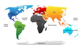
Vector illustration of a NEW 2011 High Detail Political Map of the world with different colors for each continent and variations for each country. Global colors used, easy to edit.
CATEGORIES
Sharing is not just caring, it's also about giving credit - add this image to your page and give credit to the talented photographer who captured it.:
KEYWORDS
africa alaska america americas and art asia australasia border caribbean cartography central clip color colored continent east europe globe horizontal illustration image indian islands isolated macro map middle multi national north oceania pacific painting people planet sea south southeast southern state subcontinent the transcaucasia usa vector west white world
More images on Dreamstime


Similar Images


More images by the same author


1 week free trial. Any size, for free
Renews at $25/month, cancel or upgrade at any time
Click here for your free trial!240,822,424 images | 1,214,551 contributors | 53,308,141 total users