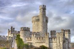
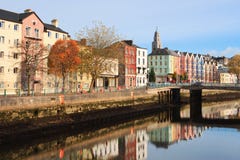
Cork - Map of the southernmost county of Ireland. In it is Queenstown, on the Cork Harbour, and important port of call for trans-Atlantic shipping. Cork is the second largest city in Ireland, located in the south-west of Ireland, in the province of Munster.
CATEGORIES
EXCLUSIVE
Your image is downloading.
Sharing is not just caring, it's also about giving credit - add this image to your page and give credit to the talented photographer who captured it.:
More images on Dreamstime


Similar Images


More images by the same author


Special Dreamstime offer
1 week free trial. Any size, for free
Renews at $25/month, cancel or upgrade at any time
Click here for your free trial!241,325,410 images | 1,215,701 contributors | 53,361,297 total users