Stock Photo: Urban Infrastructure From Above: Roads And Waterways Intersection
ID 310239886 © Bjorn999 | Megapixl.com
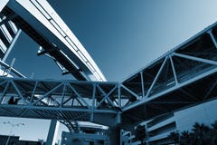
The bird's-eye view in this photograph captures the intersection of urban infrastructure where roadways and a waterway converge. The composition is a study in geometry and organization, showcasing the planned layout of the city. Vehicles appear toy-like from this height, moving along the marked lanes, while the waterway runs parallel, bordered by concrete edges. The overpass creates an additional layer to the urban landscape, demonstrating the complexity of transportation networks in a modern city. The image serves as an example of urban planning, highlighting how different modes of transport are accommodated within the space of a city. Urban Infrastructure from Above: Roads and Waterways Intersection. High quality photo
CATEGORIES
Sharing is not just caring, it's also about giving credit - add this image to your page and give credit to the talented photographer who captured it.:
KEYWORDS
aerial view urban infrastructure roadways waterway intersection city planning transportation vehicles geometric patterns organized layout landscape overpass modern network cityscape concrete lanes traffic bridge cars movement life water transport design logistics connectivity thoroughfare canal development birdseye and civil engineering travel routes metropolitan accessibility
More images on Dreamstime


Similar Images


More images by the same author


1 week free trial. Any size, for free
Renews at $25/month, cancel or upgrade at any time
Click here for your free trial!244,349,580 images | 1,225,230 contributors | 53,641,356 total users