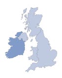
Illustration: United Kingdom - Political Map Of Administrative Divisions
ID 265246452 © Pytyczech | Megapixl.com
United Kingdom of Great Britain and Northern Ireland, UK. Metropolitan and non-metropolitan counties and unitary authorities of England, districts of Northern Ireland, council areas of Scotland, county boroughs, counties and cities of Wales. With crown dependencies. Colorful map with labels. Simple flat vector illustration.
CATEGORIES
Sharing is not just caring, it's also about giving credit - add this image to your page and give credit to the talented photographer who captured it.:
KEYWORDS
britain map scotland wales geography london england british uk country english county metropolitan non district administrative division political ireland land union outline silhouette northern kingdom vector cartography boundary state national great united island crown dependencies border region regional chart information shire name label cymru colored colorful colourful
More images on Dreamstime


Similar Images


More images by the same author


1 week free trial. Any size, for free
Renews at $25/month, cancel or upgrade at any time
Click here for your free trial!243,200,336 images | 1,221,805 contributors | 53,538,055 total users