Illustration: United Kingdom Administrative Districts High Detailed Vector Map Colored By Regions With Editable And Labelled Layers
ID 133268493 © Jktu21 | Megapixl.com
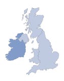
United Kingdom administrative districts detailed vector map colored by regions with editable and labelled layers
CATEGORIES
Sharing is not just caring, it's also about giving credit - add this image to your page and give credit to the talented photographer who captured it.:
KEYWORDS
administrative and berkshire britain buckinghamshire cambridgeshire cartography ceremonial cheshire colored country county derbyshire detailed devon districts dorset durham east editable england essex geography glasgow gloucestershire great greater hampshire hertfordshire high ireland kent kingdom labelled lancashire layers leicestershire london manchester map merseyside midlands norfolk north northern nottinghamshire oxfordshire regions scotland somerset south staffordshire suffolk surrey sussex travel tyne united vector wales wear wiltshire yorkshire
More images on Dreamstime


Similar Images


More images by the same author


1 week free trial. Any size, for free
Renews at $25/month, cancel or upgrade at any time
Click here for your free trial!240,869,446 images | 1,214,645 contributors | 53,313,495 total users