Search results
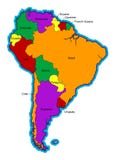
Illustration: South America Single States Political Map
ID 105224978 © Peterhermesfurian | Megapixl.com
South America single states political map. All countries in different colors, with national borders and country names. English labeling and scaling. Illustration on white background.
CATEGORIES
Your image is downloading.
Sharing is not just caring, it's also about giving credit - add this image to your page and give credit to the talented photographer who captured it.:
More images on Dreamstime


Similar Images


More images by the same author


Special Dreamstime offer
1 week free trial. Any size, for free
Renews at $25/month, cancel or upgrade at any time
Click here for your free trial!240,789,429 images | 1,214,407 contributors | 53,304,817 total users