Search results
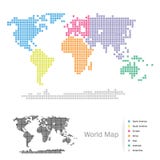
Illustration: Seven Continents Map With National Borders
ID 78425971 © Peterhermesfurian | Megapixl.com
Seven continents map with national borders. Asia, Africa, North and South America, Antarctica, Europe and Australia. Detailed map under Robinson projection and English labeling on white background.
CATEGORIES
Your image is downloading.
Sharing is not just caring, it's also about giving credit - add this image to your page and give credit to the talented photographer who captured it.:
More images on Dreamstime


Similar Images


More images by the same author


Special Dreamstime offer
1 week free trial. Any size, for free
Renews at $25/month, cancel or upgrade at any time
Click here for your free trial!240,491,162 images | 1,213,664 contributors | 53,272,601 total users