Stock Photo: Satellite View Of The Amazon, Map, States Of South America, Reliefs And Plains, Physical Map
ID 129477433 © Vampy1 | Megapixl.com
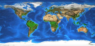
Satellite view of the Amazon, map, states of South America, reliefs and plains, physical map. Forest deforestation. 3d rendering. Element of this image is furnished by NASA
CATEGORIES
Sharing is not just caring, it's also about giving credit - add this image to your page and give credit to the talented photographer who captured it.:
KEYWORDS
amazon america and background beach brazil brazilian cartography city continent country deforestation earth element environment forest furnished geography globe green house image island isolated jungle landscape latin manaus map nasa nation national nature ocean physical plains planet rain reliefs rendering rio river rivers satellite sea south states this tourism tourist travel tree trip tropical vector view water wild wood
More images on Dreamstime


Similar Images


More images by the same author


1 week free trial. Any size, for free
Renews at $25/month, cancel or upgrade at any time
Click here for your free trial!240,548,222 images | 1,213,823 contributors | 53,278,715 total users