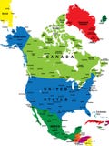
Panama political map with capital Panama City, national borders, neighbor countries and the Panama Canal. Republic in North and Central America. Gray illustration, English labeling, over white. Vector
CATEGORIES
Sharing is not just caring, it's also about giving credit - add this image to your page and give credit to the talented photographer who captured it.:
KEYWORDS
america americas azuero background canal cargo caribbean cartography central city colombia colon costa country cruise destination english geography gray illustration labeling map north panama passage peninsula political republic rica route shipping ships transport travel vector waterway white
More images on Dreamstime


Similar Images


More images by the same author


1 week free trial. Any size, for free
Renews at $25/month, cancel or upgrade at any time
Click here for your free trial!242,843,593 images | 1,220,803 contributors | 53,505,451 total users