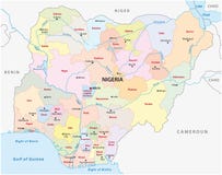
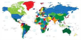
Detailed map of Nigeria. Each file is constructed using multiple layers including country borders, county names, main roads and a highly detailed state silhouette. Each file is fully customizable with the ability to change the color of individual counties to suit your needs.
CATEGORIES
Sharing is not just caring, it's also about giving credit - add this image to your page and give credit to the talented photographer who captured it.:
KEYWORDS
abstract africa african area art atlantic atlas background benin black border burkina cameroon central chad complete congo continent country design detailed djamena earth eastern emblem equatorial gabon geographic geography global guinea illustration lagos mali map niamey niger nigeria novo ocean orange political porto sahara sign silhouette south transportation travel united vector wallpaper western world yaounde
More images on Dreamstime


Similar Images


More images by the same author


1 week free trial. Any size, for free
Renews at $25/month, cancel or upgrade at any time
Click here for your free trial!240,680,951 images | 1,214,081 contributors | 53,294,166 total users