Illustration: Mexico Administrative Map With States. Colored. Vector
ID 279398553 © Mapcorn | Megapixl.com
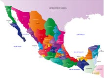
Mexico administrative map with Mexico City and states. México, Jalisco, Veracruz, Puebla, Guanajuato, Nuevo León, Chiapas, Michoacán, Oaxaca, etc
CATEGORIES
Sharing is not just caring, it's also about giving credit - add this image to your page and give credit to the talented photographer who captured it.:
KEYWORDS
map diagram line cartoon soil plan drawing illustration presentation text sketch brand screenshot font pattern document advertising circle design terrain mexico administrative states colored vector australian capital territory territor city cit méxico jalisco veracruz puebla guanajuato nuevo león chiapas michoacán oaxaca etc administrative map aguascalientes baja california california sur border campeche cartography chiapas chihuahua coahuila colima colored contour country division durango geography guanajuato guerrero hidalgo illustration jalisco mexico state michoacán morelos nayarit león oaxaca outline political puebla querétaro quintana roo region san luis potosí sinaloa sonora state tabasco tamaulipas tlaxcala travel vector veracruz yucatán zacatecas
More images on Dreamstime


Similar Images


More images by the same author


1 week free trial. Any size, for free
Renews at $25/month, cancel or upgrade at any time
Click here for your free trial!242,682,325 images | 1,220,330 contributors | 53,490,848 total users