Illustration: Flat World Map Divided Into Editable Contours Of Countries. Country Names.
ID 186911396 © Anavalny | Megapixl.com
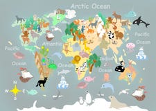
Flat world map divided into editable contours of countries. Country names. Template for your design works. Vector illustration.
CATEGORIES
Sharing is not just caring, it's also about giving credit - add this image to your page and give credit to the talented photographer who captured it.:
KEYWORDS
abstract africa america antarctica asia atlas australia background blank business capital cartography continent contour contours countries country design divided earth east editable education element europe flat geographic global graphic illustration island isolated lake map meridian names new north ocean parallel planet recreation sea silhouette south template topography tourism transportation travel usa vacation vector west works world your zealand
More images on Dreamstime


Similar Images


More images by the same author


1 week free trial. Any size, for free
Renews at $25/month, cancel or upgrade at any time
Click here for your free trial!240,474,333 images | 1,213,558 contributors | 53,270,709 total users