Illustration: Fennoscandia, Fennoscandian Peninsula, Political Map
ID 249968462 © Peterhermesfurian | Megapixl.com
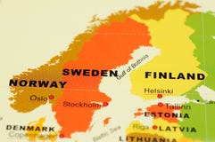
Fennoscandia, Fennoscandian Peninsula, political map. Peninsula, comprising the Scandinavian and Kola Peninsulas, mainland of Finland, Norway and Sweden, Murmansk Oblast, and the Republic of Karelia.
CATEGORIES
Sharing is not just caring, it's also about giving credit - add this image to your page and give credit to the talented photographer who captured it.:
KEYWORDS
arctic atlas baltic border boundary cartography continent country cruise destination europe european fennia fenno fennoscandia fennoscandian finland geography illustration karelia kola ladoga lake land lapland mainland map mapping murmansk nordic northern norway oblast onega peninsula political region russia sapmi scandia scandinavia scandinavian sea sweden travel vector
Similar Images


More images by the same author


1 week free trial. Any size, for free
Renews at $25/month, cancel or upgrade at any time
Click here for your free trial!242,942,897 images | 1,221,055 contributors | 53,514,915 total users