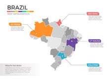
Brazil map designed in illustration with the 26 states colored in bright colors and with the main cities. On an illustration neighbouring countries are shown too
CATEGORIES
EXCLUSIVE
Sharing is not just caring, it's also about giving credit - add this image to your page and give credit to the talented photographer who captured it.:
KEYWORDS
administrative america argentina art atlantic bolivia border brasilia brazil brazilian chile city colombia concept continent country design district ecuador falkland finance flag french frontier globe green guiana guyana illustrated illustration island islands isolated janeiro land map mapping names nation national north paraguay patchwork pattern peru political province provinces rio salvador sections segregated set sign south state suriname travel trinidad union uruguay vector venezuela world
More images on Dreamstime


Similar Images


More images by the same author


1 week free trial. Any size, for free
Renews at $25/month, cancel or upgrade at any time
Click here for your free trial!241,618,908 images | 1,216,687 contributors | 53,390,909 total users