Illustration: Africa - Highly Detailed Editable Political Map With Separated Layers.
ID 143237880 © Pbardocz | Megapixl.com
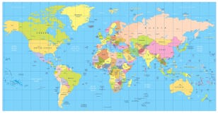
Africa - Highly detailed editable political map with separated layers. Vector illustration.
CATEGORIES
Sharing is not just caring, it's also about giving credit - add this image to your page and give credit to the talented photographer who captured it.:
KEYWORDS
africa african algeria atlantic atlas background capital cartography city colored congo continent contour country dakar depth earth editable egypt geographic geography graphic illustration kilimanjaro label land libya map mapping national nile ocean outline pacific pastel river road shaded shape south tanzania territory topographic topography transport transportation travel vector
More images on Dreamstime


Similar Images


More images by the same author


1 week free trial. Any size, for free
Renews at $25/month, cancel or upgrade at any time
Click here for your free trial!240,587,690 images | 1,213,941 contributors | 53,283,286 total users