Stock Photo: Uk Map In Satellite Photo, England Terrain View From Space
ID 201312175 © Scaliger | Megapixl.com
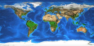
UK map in satellite photo, England terrain view from space. Physical topographic map of Great Britain and Ireland islands. Detailed photography of United Kingdom. Elements of image furnished by NASA
CATEGORIES
Sharing is not just caring, it's also about giving credit - add this image to your page and give credit to the talented photographer who captured it.:
KEYWORDS
aerial atlantic atlas background britain british cartographic detailed earth england europe flat flattened geo geography globe great green image ireland islands isles kingdom land landforms landscape london map nasa nature orbit overview photo photography physical planet projection relief satellite scotland sea space surface terrain texture top topography united view world
More images on Dreamstime


Similar Images


More images by the same author


1 week free trial. Any size, for free
Renews at $25/month, cancel or upgrade at any time
Click here for your free trial!240,437,232 images | 1,213,504 contributors | 53,266,865 total users