Illustration: Street And Political Map Of Europe And North Africa. European Cities. Political Map With The Border Of The States. Urban Areas
ID 110972012 © Vampy1 | Megapixl.com
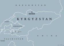
Street and political map of Europe and North Africa. European cities. Political map with the border of the states. Urban areas. Street directory, atlas.
CATEGORIES
Sharing is not just caring, it's also about giving credit - add this image to your page and give credit to the talented photographer who captured it.:
KEYWORDS
africa algeria and areas atlas border borders cities countries cyprus denmark design directory divisions egypt england estonia europe european finland france germany greece holland iraq islands israel italy latvia lebanon libya links lithuania luxembourg map mediterranean north norway political roads russia sea spain states street style sweden syria tunisia turkey ukraine urban
More images on Dreamstime


Similar Images


More images by the same author


1 week free trial. Any size, for free
Renews at $25/month, cancel or upgrade at any time
Click here for your free trial!240,350,720 images | 1,213,213 contributors | 53,257,797 total users