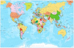
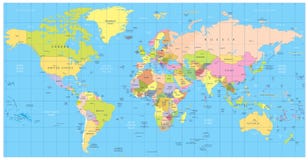
Illustration: Political World Map Vector Illustration With Different Colors For Each Continent And Different Tones For Each Country.
ID 120286647 © Antoniosantosg | Megapixl.com
Political World Map vector illustration with different colors for each continent and different tones for each country. Editable and clearly labeled layers.
CATEGORIES
Sharing is not just caring, it's also about giving credit - add this image to your page and give credit to the talented photographer who captured it.:
KEYWORDS
africa america and art asia atlas australia background borders cartography clearly clip color colorful colors continent continents country design different each earth editable education europe flat for geography global globes graphic icon illustration info infographics information isolated labeled land layers map mockup modern oceania physical planet political shape tones topography travel usa vector white world worldmap
More images on Dreamstime


Similar Images


More images by the same author


1 week free trial. Any size, for free
Renews at $25/month, cancel or upgrade at any time
Click here for your free trial!240,232,318 images | 1,212,895 contributors | 53,245,236 total users