Illustration: Physical Map Of The World, Satellite View Of Europe And North Africa. Night View. City Lights. Globe. Hemisphere. Reliefs
ID 143736958 © Vampy1 | Megapixl.com
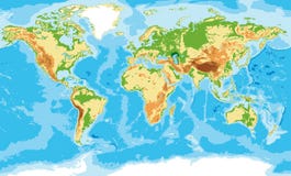
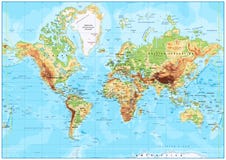
Physical map of the world, satellite view of Europe and North Africa. Night view. City lights. Globe. Hemisphere. Reliefs and oceans. 3d rendering. Elements of this image are furnished by NASA
CATEGORIES
Sharing is not just caring, it's also about giving credit - add this image to your page and give credit to the talented photographer who captured it.:
KEYWORDS
africa are asia atlantic atlas background blue cartography city colored continent contour country denmark detailed earth elements europe european finland france furnished geography germany globe graphic greece green hemisphere illustration image italy kingdom land lights map mediterranean nasa night north norway ocean oceans physical relief reliefs rendering road russia satellite scandinavia sea shaded shape spain sweden terrain this topographic topography united view world
More images on Dreamstime


Similar Images


More images by the same author


1 week free trial. Any size, for free
Renews at $25/month, cancel or upgrade at any time
Click here for your free trial!239,786,826 images | 1,211,396 contributors | 53,195,449 total users