Search results
Illustration: Latin America Single States Map Full Color
ID 78461109 © Peterhermesfurian | Megapixl.com
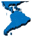
Latin America single states map. All countries in different full intense colors and with national borders. From northern border of Mexico to the southern tip of South America, including the Caribbean.
CATEGORIES
Your image is downloading.
Sharing is not just caring, it's also about giving credit - add this image to your page and give credit to the talented photographer who captured it.:
More images on Dreamstime


Similar Images


More images by the same author


Special Dreamstime offer
1 week free trial. Any size, for free
Renews at $25/month, cancel or upgrade at any time
Click here for your free trial!239,650,755 images | 1,210,781 contributors | 53,178,600 total users