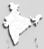
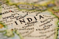
India map designed in illustration with regions colored in bright colors and with the main cities. Neighbouring countries are in an additional format (.AI) in the latent layer.
CATEGORIES
EXCLUSIVE
Sharing is not just caring, it's also about giving credit - add this image to your page and give credit to the talented photographer who captured it.:
KEYWORDS
administrative art asia blue button cartography central city close cool countries delhi design district element flag government graphic gray green illuminated illustration india indian insignia isolated map marbled modern nation national new painting patriotism province reflection shape shiny simplicity single south travel vector
More images on Dreamstime


Similar Images


![Map India [Labeled] Authentic](https://thumbs.dreamstime.com/t/map-india-labeled-authentic-4933985.jpg)


![Map of India[outline]Authentic](https://thumbs.dreamstime.com/t/map-india-outline-authentic-4933962.jpg)


More images by the same author


1 week free trial. Any size, for free
Renews at $25/month, cancel or upgrade at any time
Click here for your free trial!240,422,588 images | 1,213,444 contributors | 53,264,736 total users