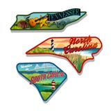
Illustration: Illustrated Pictorial Map Of Southwest United States.
ID 137988349 © rogerothornhill | Megapixl.com
Illustrated pictorial map of southwest United States. Includes California, Nevada, Utah, Arizona, New Mexico and Colorado. Vector Illustration.
CATEGORIES
Sharing is not just caring, it's also about giving credit - add this image to your page and give credit to the talented photographer who captured it.:
KEYWORDS
aces america arizona buttes cactus california cards coast colorado desert design dice drawing educational elements gambling illustrated illustration includes landmarks landscape las map mexico mountains nature nevada new outdoors outline pictorial poster puzzle skiing southwest states sticker sunset surfing travel united utah vector vegas west
More images on Dreamstime


Similar Images


More images by the same author


1 week free trial. Any size, for free
Renews at $25/month, cancel or upgrade at any time
Click here for your free trial!240,461,401 images | 1,213,544 contributors | 53,268,948 total users