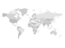
Illustration: Grey Political World Map With Country Borders And White State Name Labels.
ID 85574114 © Pytyczech | Megapixl.com
Grey political World map with country borders and white state name labels. Hand drawn simplified vector illustration.
CATEGORIES
Sharing is not just caring, it's also about giving credit - add this image to your page and give credit to the talented photographer who captured it.:
KEYWORDS
africa america asia atlas australia border business cartography continent country design detail detailed earth education europe geographical geography global globe gray grey illustration information label land map name national north ocean oceania political sea silhouette simple simplified south state topography travel usa vector wallpaper white world
More images on Dreamstime


Similar Images


More images by the same author


1 week free trial. Any size, for free
Renews at $25/month, cancel or upgrade at any time
Click here for your free trial!239,896,586 images | 1,211,719 contributors | 53,207,912 total users