Illustration: Europe Regions, Political Map, With Single Countries
ID 110444670 © Peterhermesfurian | Megapixl.com
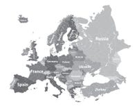
Europe regions, political map, with single countries. Northern, Western, Southeastern, Eastern, Central, Southern and Southwestern Europe in different colors. English labeling. Illustration. Vector.
CATEGORIES
Sharing is not just caring, it's also about giving credit - add this image to your page and give credit to the talented photographer who captured it.:
KEYWORDS
atlas background cartography central color continent country east eastern english europe european geography group illustration isolated labeling map north northern outline political region regions shape silhouette single south southeastern southern southwestern state subregion vector west western white
More images on Dreamstime


Similar Images


More images by the same author


1 week free trial. Any size, for free
Renews at $25/month, cancel or upgrade at any time
Click here for your free trial!239,863,089 images | 1,211,487 contributors | 53,203,480 total users