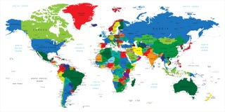
Illustration: Blue World Map - Borders, Countries And Cities -Illustration.
ID 63513537 © Dikobrazik | Megapixl.com
Highly detailed vector illustration of world map. Image contains land contours, country and land names, city names, water object names.
CATEGORIES
Sharing is not just caring, it's also about giving credit - add this image to your page and give credit to the talented photographer who captured it.:
KEYWORDS
africa america americas asia atlantic australia blue canada china city continents countries country detailed earth east equipment europe france germany illustration information italy japan land map mediterranean medium middle navigational new north ocean oceania pacific painting region round rounded russia sea shape south spain star usa vector world zealand
More images on Dreamstime


Similar Images


More images by the same author


1 week free trial. Any size, for free
Renews at $25/month, cancel or upgrade at any time
Click here for your free trial!240,430,020 images | 1,213,473 contributors | 53,265,589 total users